
Today’s Sunday Morning Adventure took me to up to Mount Airy, Georgia (not where they filmed Andy Griffith’s Mayberry) to NancyTown Creek Falls. I left the house around 6:00 AM and stopped for gas and coffee. Then headed north on mostly 4 lane highways to get to Mount Airy. The sky was striped with orange clouds in layers as the sun rose and the radio was playing a mix of 70’s rock and Dr Espisito’s health tips.
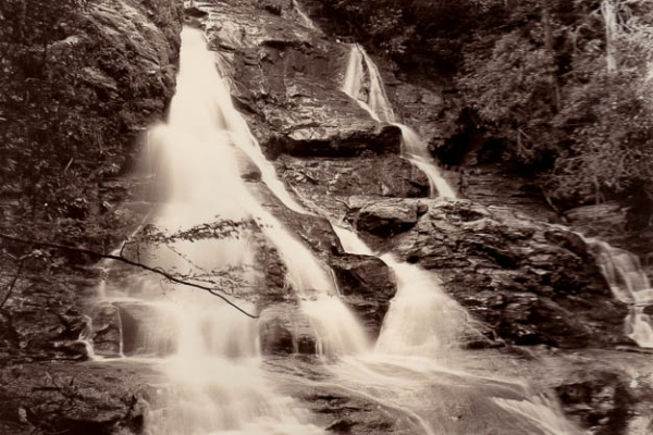
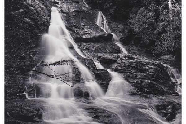
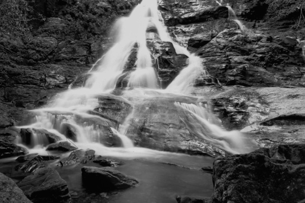
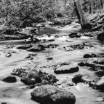
Turning onto Nancytown Road the paved road gave way to gravel, though well maintained. The road ends at another unmarked road that allows you to go right to the camping area or left toward the falls. At the point where Nancytown road crosses the creek is a view of the lower falls. The falls are moderately wide with a couple of tiers back in the woods. I set up in a couple of different elevations on the rocks to get more of the higher level details. While not a large waterfall, it had some charm. It would be at its best after a heavy rain.
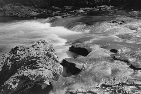
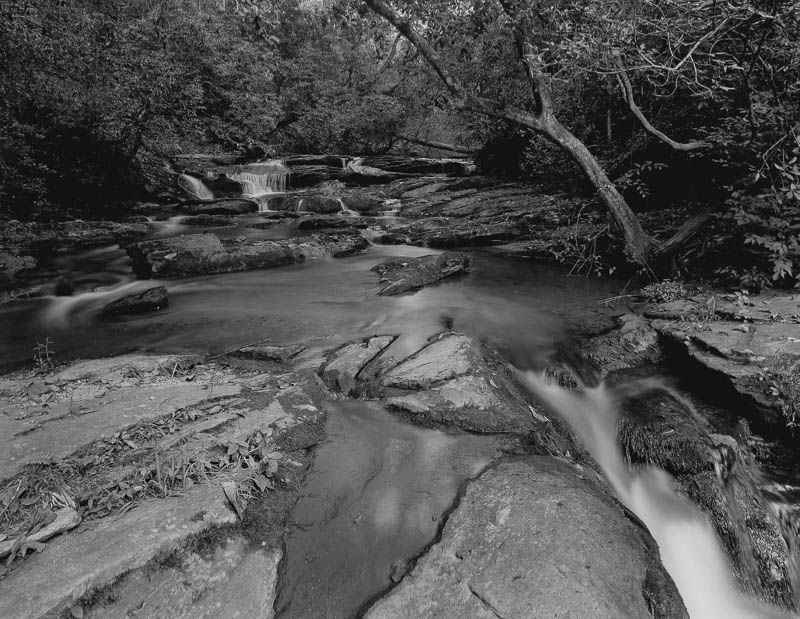
There is a trail that runs along side the creek that goes to another set of falls. Its an easy 1 mile hike with minimal elevation changes. The trail follows the creek but at times the water is silent. At about a 8/10ths of a mile in, the wooded narrow path opens onto a large marshy area where the water looks more stagnant, supposedly an old beaver pond. Further up the trail you finally run into the upper falls. These are large rocks with a lot of fallen trees piling up on them. There is also not much water running through here so one has to work to find an interesting shot. I managed to climb up the falls a bit and find a slot where the water was moving through quickly and formed a pool. At the base of the falls is a short trail that led to another opportunity to capture the creek and some twisted mountain laurel and rhododendron. Always look behind you and follow that less used trail, there are always surprises. Today I had the trail and falls to myself except for an older woman camping and hiking with her cat … on a leash. She wasn’t friendly, nor was the cat.
When hiking back you have option to take a spur trail which loops back to the road near the camping area. I chose not to this time. When I got back in the car to leave I decided to continue down the gravel road and see what else might be there. I drove for a good 20 minutes before I found an old grave yard that was once near a church and school. Most of the graves were from the 1800s and minimally carved. A small historic marker gave information about the site and the mountain people it supported. Back onto the dirt road for another 30 minutes. At one point I found a fork in the road at an old homestead. There were vultures sitting in a dead tree so of course I took that fork which was soon to be a “dead end”. Not all who wander mountain forest service roads are lost. I finally found my way back to pavement and was able to establish a GPS route to get me back to the highway. The return trip was uneventful, but I did note signs for Taccoa Falls, a military museum, and an upcoming festival in Cornelia in October.
Technical notes: I exposed 5 sheets of film today and felt good about all of the shots. I don’t think I made any major errors and am confident I set the aperture correctly. The scenes were generally in low light and required unusually longer exposures compared to larger more open waterfall and river shots. Most of todays shots were in the 14 second range at f32. So the water will be milky and hopefully the shadows open. I used my 65mm, 135mm, and 180mm lenses today and FP4+ film only. I did not lose any lens caps, loupes, or other gear today.
Processed all 5 sheets in dilute Pyrocat HD for my normal time since subject brightness was within 5-6 stops. Scan of print on Ilford MGFB Classic using LPD 1:1. I may tone this to a deep brown since it feels a bit cold to my eye.
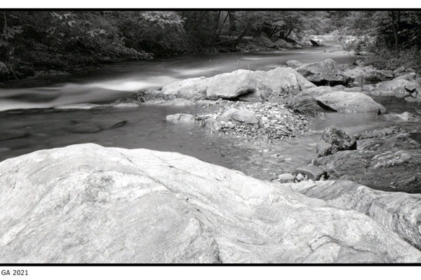
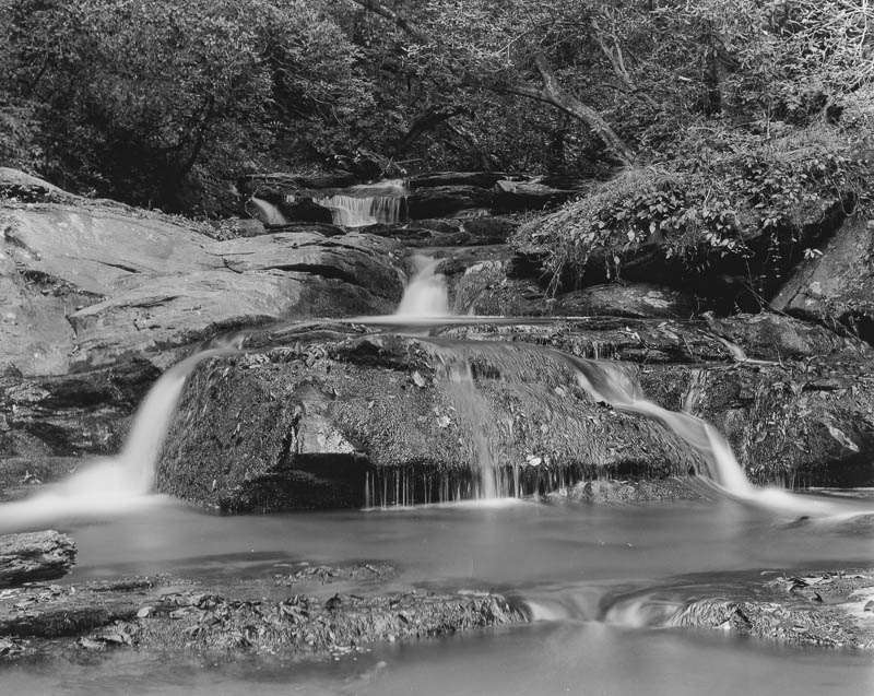
Below is a slightly more elevated view of the Lower falls. I was standing ont the dry rocks to the left in the image above. I used a wide angle lens to capture the center falls and to emphasize the depth of the receding creek back into the woods.
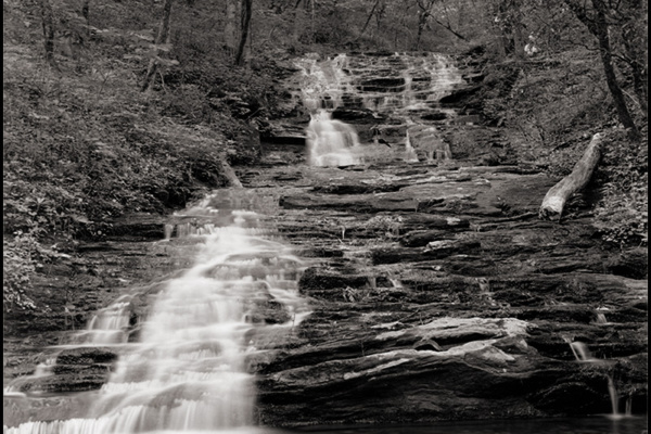
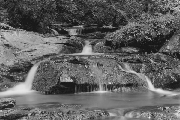
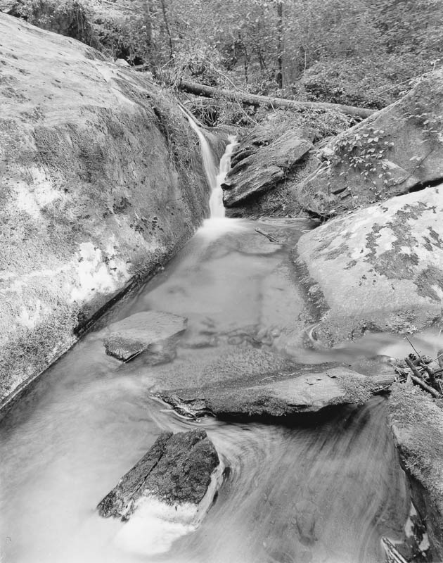
And the upper slot further up the trail. The water is comming from the rock up and to the left, and exiting right in the lower right of this image.
The other shots had some weak points so they will not be displayed.
 FrogTown Creek Revisited
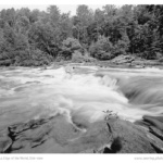 Winter Blahs
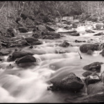 Amicalola Creek